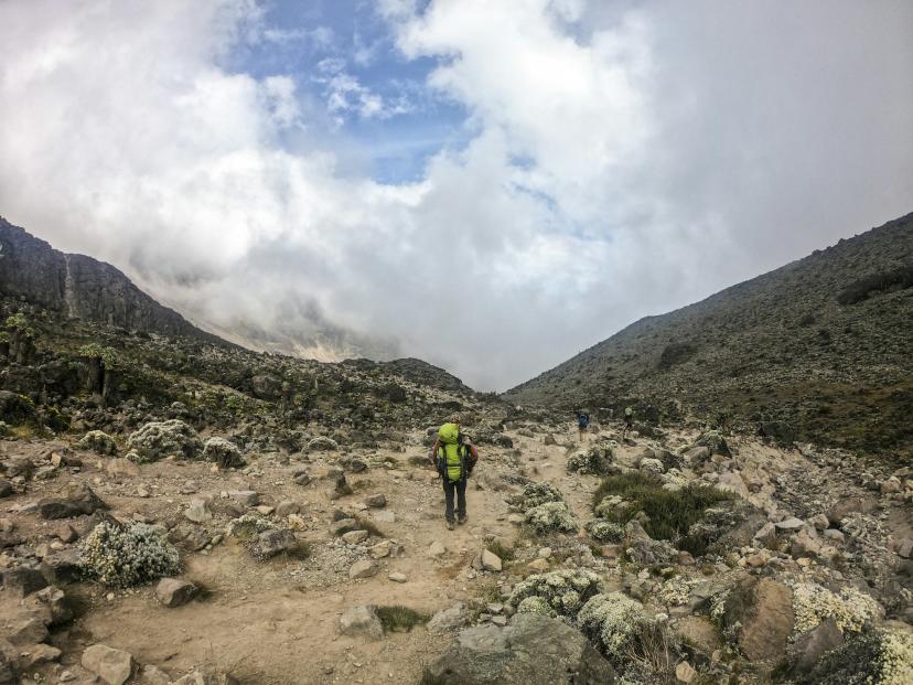
Rongai Route: Kilimanjaro's Quiet North Side
The Rongai Route is the only route that approaches Kilimanjaro from the north, starting near the Kenya border. This unique positioning gives it two significant advantages: it is the driest route on the mountain (the northern slopes sit in a rain shadow) and it is one of the least crowded options. For climbers who value solitude or who need to trek during the wetter shoulder seasons, Rongai is an excellent and underrated choice.
The trade-off is that Rongai's scenery is generally considered less dramatic than the southern routes. The northern slopes are drier and more uniform - pine-like forest rather than lush tropical rainforest, and open moorland without the giant groundsels and lobelias that define the Machame and Lemosho approaches. However, the route offers its own rewards: views into Kenya, a passage past the dramatic Mawenzi peak, and a genuine sense of wilderness that the busier routes have lost.
Route Overview
| Detail | Information |
|---|---|
| Starting Gate | Rongai Gate (1,950m) |
| Summit Approach | Via School Hut / Gilman's Point |
| Descent | Marangu Route |
| Duration | 6-7 days (7 recommended) |
| Distance | ~65 km |
| Accommodation | Tent camping |
| Difficulty | Moderate |
| Scenery | Good - less varied than southern routes |
| Traffic | Low |
| Success Rate | 80% (6-day), 85% (7-day) |
Day-by-Day Itinerary (7 Days)
Day 1: Rongai Gate (1,950m) to Simba Camp (2,625m)
Distance: 8 km | Hiking Time: 3-4 hours | Elevation Gain: 675m
The drive from Moshi to Rongai Gate takes approximately 2-2.5 hours through the drier northern lowlands of Kilimanjaro. The trek begins in cultivated farmland before entering a forest of pine and juniper - distinctly different in character from the tropical forests on the southern slopes. The trail is gentle and well-shaded. Simba Camp ("Lion Camp") sits at the edge of the forest with views northward into Kenya on clear days.
Day 2: Simba Camp (2,625m) to Kikelewa Camp (3,630m)
Distance: 9 km | Hiking Time: 5-7 hours | Elevation Gain: 1,005m
The trail climbs through the upper forest zone, which here consists of gnarled, moss-covered trees and a dense understorey of ferns. Emerging above the treeline, the landscape opens into rolling heath and moorland. The rugged pinnacles of Mawenzi - Kilimanjaro's second peak - become increasingly prominent to the east. Kikelewa Camp sits in a small valley with good shelter from wind.
Day 3: Kikelewa Camp (3,630m) to Mawenzi Tarn (4,330m)
Distance: 5 km | Hiking Time: 3-5 hours | Elevation Gain: 700m
A shorter day that ascends steeply to Mawenzi Tarn, a small alpine lake nestled beneath the towering rock faces of Mawenzi peak. This is one of the most dramatic campsites on Kilimanjaro. The jagged spires of Mawenzi rise vertically above the camp, and the tarn itself reflects the peak in still conditions. The camp is exposed and cold - temperatures drop well below freezing at night.
Day 4: Mawenzi Tarn (4,330m) - Acclimatization Day
Hiking Time: 2-3 hours | Elevation Gain/Loss: Variable
An acclimatization day at Mawenzi Tarn. You take a hike toward the base of Mawenzi peak, reaching approximately 4,600-4,800 metres before returning to camp. This walk high, sleep low strategy is invaluable preparation for the summit push. The surroundings are austere but beautiful - raw volcanic rock, scree slopes, and a profound sense of remoteness.
Day 5: Mawenzi Tarn (4,330m) to School Hut / Kibo Hut (4,750m)
Distance: 6 km | Hiking Time: 4-5 hours | Elevation Gain: 420m
The trail crosses the saddle - the vast, barren plateau between Mawenzi and Kibo. The landscape is stark alpine desert, with minimal vegetation and fine volcanic gravel underfoot. You arrive at School Hut (or nearby Kibo Hut) by early afternoon. Early dinner, rest, and an attempt at sleep before the midnight call.
Day 6: School Hut (4,750m) to Uhuru Peak (5,895m) to Horombo Hut (3,720m)
Distance: 16 km | Hiking Time: 12-16 hours | Elevation Gain/Loss: +1,145m / -2,175m
Summit night follows the same approach as the Marangu Route from Kibo Hut: steep switchbacks to Gilman's Point (5,681m), then along the crater rim via Stella Point to Uhuru Peak. The descent is via the Marangu Route, passing Kibo Hut and continuing across the saddle to Horombo Hut. Descending a different route gives you new scenery and avoids the steep scree slopes you climbed in the dark.
Day 7: Horombo Hut (3,720m) to Marangu Gate (1,860m)
Distance: 20 km | Hiking Time: 5-7 hours | Elevation Loss: 1,860m
The final day descends through moorland and lush rainforest via the Marangu Route to Marangu Gate. Collect your summit certificate and transfer back to Moshi.
Why Choose Rongai
- Driest route: Ideal for climbing during shoulder seasons when southern routes are wet
- Quietest approach: The least-trafficked route, especially on the first three days
- Mawenzi Tarn: One of the most spectacular campsites on the mountain
- Descent variety: Going up Rongai and down Marangu gives you two different perspectives of the mountain
- Good acclimatization: The 7-day itinerary with the Mawenzi Tarn rest day provides solid preparation for the summit
What to Consider
- Long drive to the gate: 2-2.5 hours from Moshi each way
- Less scenic than southern routes: The northern forest and moorland lack the dramatic variety of Machame and Lemosho
- Steeper summit approach: Shares the demanding Gilman's Point approach with Marangu
- Camp facilities are basic: Less established infrastructure than the busier southern routes